Australia's Water Sports Planner

KNOW THE WATER. OWN THE RIDE.

Built for Australian jet ski riders and boaties. Live conditions, smart trip planning, safety tools and a local crew - all in one place.

4 Regions
40+ Challenges
100% Free to Start

Built for the water

EVERYTHING YOU NEED
BEFORE YOU LAUNCH

Southport Boat Ramp
Launch point
42 km  ·  2h 30m
South Straddie
Destination

TRIP PLANNING

Pick your launch ramp, set your stops, and get a complete ride plan with distance, fuel and time - tailored to your experience level.

Wind
SE 12 KTS
Swell
0.8m
Tide
Incoming ↑
UV Index
9 High
Temp
27°C
Status
GOOD

LIVE CONDITIONS

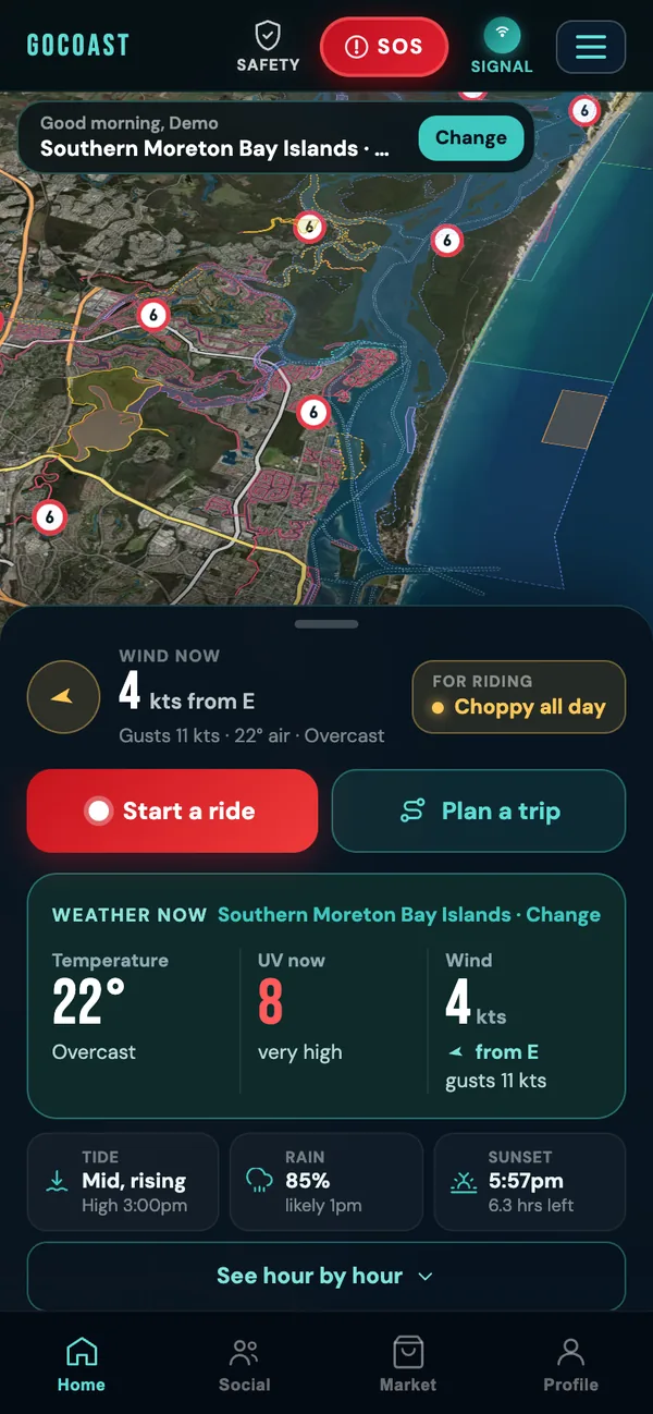
Wind, swell, tide, UV and water temp for your region - before you hook up the trailer. Know if it's worth going before you leave.

Tipplers Café 4.8
Water accessible · Queensland

EXPLORE

Boat ramps, snorkel sites, water-accessible cafés, anchorages and hidden spots - all mapped and rated by locals who actually ride.

Emergency Contacts
Triple Zero 000
VMR Gold Coast 5591 5955
QLD Water Police 131 444
Dec 2024 QLD regulations

SAFETY

One tap to Triple Zero, VMR and QLD Water Police. Marine checklists, speed zone maps and life jacket rules - updated for Dec 2024 QLD law.

JG
Jake_GC
42 km · 2h 15m · Broadwater
"Seaway to Jumpinpin. Perfect day."
24 6 +80 pts

COMMUNITY

Post sessions, join local groups and climb the leaderboard. Earn badges for milestones. The riding community lives here.

42.3
km
2:15
hrs
22
km/h avg

RIDE LOG

Record every session with GPS tracking. Log distance, time and route. Build your history and see your progress over the season.

GoCoast explore map showing nearby food and eats spots
Nearby
Tipplers Café
Food · North Stradbroke Island
⭐⭐⭐⭐⭐ Top rated
On the Map
20+
Food stops
30+
Snorkel

Explore Map

FIND YOUR
SPOT.

Every boat ramp, fuel dock, waterfront café, snorkel site, anchor spot and hazard across four regions — and expanding. All accessible by water. None on Google Maps.

Boat Ramps Waterfront Eats Snorkel Spots Fuel Docks Hazards
Explore the map →

Crew Events

RIDE WITH
YOUR CREW.

Post a ride, set the spots, and watch your crew fill them. Open rides for new mates, crew-only cruises for your regulars — organised in one tap, not a group chat spiral.

Group Rides Open Invites Crew-Only RSVP Tracking
See what's on →
GoCoast crew events screen showing upcoming group rides
Next Up
Morning Wave Chase
Sat 7:00am · 2/10 spots free
Open ride
This Week
3
Rides
24
Riders
GoCoast GPS ride replay screen showing route playback
Last Ride
Stradbroke
Passage
16.3
km
26:33
time
58
kph max
This Season
2,340
km logged · 14 sessions

GPS Ride Log

LOG EVERY
SESSION.

GPS recording runs in the background. Distance, max speed, route replay, session time. Every ride saved, searchable and shareable. Your whole season, on the water.

GPS Tracking Route Replay Speed Stats Share Your Ride
Start logging →

Leaderboard

CLIMB THE
RANKS.

Every ride you log stacks up against the crew. Longest, fastest, most rides, most cruises — regional leaderboards that turn your Saturday session into bragging rights.

Longest Ride Fastest Speed Most Rides Regional Ranks
Check the board →
GoCoast regional leaderboard screen
Top Rider
75.2 km
@WaveRunner_Dave
🏆 #1 Longest ride
Ranked By
4 Categories
Longest · Fastest · Rides · Cruises

The Full Experience

A DAY ON THE WATER

5:30 AM

CHECK CONDITIONS

Before you get out of bed - check wind, swell, tide and UV. Know if it is worth going before you hook up the trailer.

6:15 AM

PLAN YOUR ROUTE

Pick your ramp, set waypoints and save the plan. See water-accessible cafes, anchorages and snorkel spots along the way.

7:00 AM

HIT THE RAMP

Find the nearest ramp with depth info and facilities. No more driving out to find it full.

8:00 AM

RECORD THE RIDE

GPS tracking runs in the background. Hit record and go - your route, distance and time are logged automatically.

11:00 AM

LOG AND SHARE

Ride saved automatically. Add a note, share to the community feed and earn points toward your next badge.

Got questions

COMMON QUESTIONS

GoCoast is free to download and get started. Core tools like conditions, maps and boat ramp info are available without paying. Premium features including GPS ride recording, full ride history, badges and the community feed require a subscription. Plans are kept affordable so you spend your money on fuel, not the app.

Yes. GoCoast is built for both. Set your craft when you sign up - jet ski, boat, or both. The app tailors ramp recommendations, speed zone info and safety checklists to your vessel type.

Conditions are pulled from Bureau of Meteorology marine forecasts and real-time station data. Wind, swell, tide and UV are updated multiple times per day and shown for your specific region.

It launched on the Gold Coast, but GoCoast now covers all of Queensland - and we're expanding across Australia. The Strava-style ride logging works anywhere in the world right now.

You can browse conditions and maps without signing in. An account is needed for ride logging, the community feed, badges and saving your favourite spots - it takes about 30 seconds to set up.

GPS ride recording continues without a signal - the route is saved and synced when you're back online. Conditions and maps need a connection to update but cached data is shown when offline.

Loved by early riders5 stars from our beta crew

Free to start

GET ON THE
WATER.

Free to download and explore. Premium features unlock the full experience. Built for Australian riders, by someone who rides.